From Individual Islands to Global Synergy: "Digital Safety Fences" in Low-Altitude Traffic Management
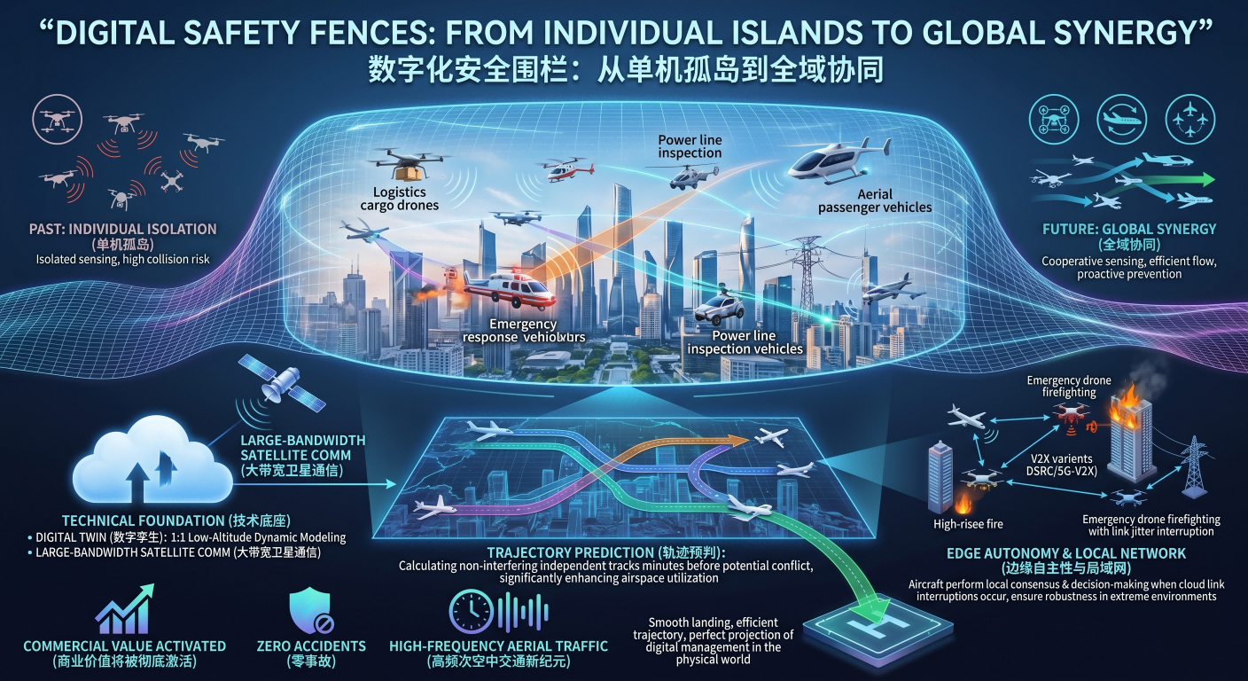
The explosive growth of the low-altitude economy is transforming the once-silent aerial domain into a busy and complex digital transportation network. As logistics delivery, emergency response, power inspection, and future aerial passenger transport operate simultaneously above a city, traditional safety models based on visual avoidance or individual radar sensing are no longer sufficient to handle high-density traffic pressure. In this era of universal connectivity, aircraft should no longer be information islands; instead,
The technical foundation for this vision is the deep integration of Digital Twin technology and high-bandwidth satellite communication. By synchronizing the real-time coordinates, dynamic vectors, and mission priorities of every aircraft in flight to edge computing gateways, the management center can reconstruct a 1:1 low-altitude dynamic scene in virtual space. This system no longer relies on the UAV making an emergency response one second before a collision; instead, based on "trajectory prediction" logic, it calculates non-interfering independent flight tracks for aircraft on different paths 30 seconds or even a minute before a conflict occurs. This forward-looking path planning significantly enhances airspace utilization, making multi-aircraft parallel operations within minimal intervals a reality.
Within this digital fence system, edge computing plays a pivotal role. Given that communication links in low-altitude environments may experience instantaneous jitter, flight platforms must possess "edge autonomy." When cloud commands cannot be delivered in time due to link interruptions, aircraft perform local situational awareness and avoidance decisions directly through high-frequency interaction protocols (such as variants based on DSRC or 5G-V2X technology). This hybrid architecture, combining global scheduling with local autonomy, ensures the system's robustness in extreme environments. Whether a UAV is executing a high-rise firefighting mission or weaving through large-scale power line inspections, it remains constantly within a multi-layered, comprehensive safety protection net.
Ultimately, this comprehensive innovation from underlying protocols to high-level management is clearing the final obstacles for the large-scale commercial operation of the low-altitude economy. By elevating individual sensing capabilities to the height of global synergy, we not only eliminate potential mid-air conflicts but also establish a credible, traceable industrial ecosystem. When aerial traffic becomes as precisely controllable as ground railway systems, the commercial value of low-altitude airspace will be fully activated. Every smooth landing and every efficient trajectory is a perfect projection of the digital management system in the physical world, signaling the dawn of a new era of high-frequency, zero-accident aerial transportation.