How LiDAR Builds Archives for the Earth's "Capillaries"
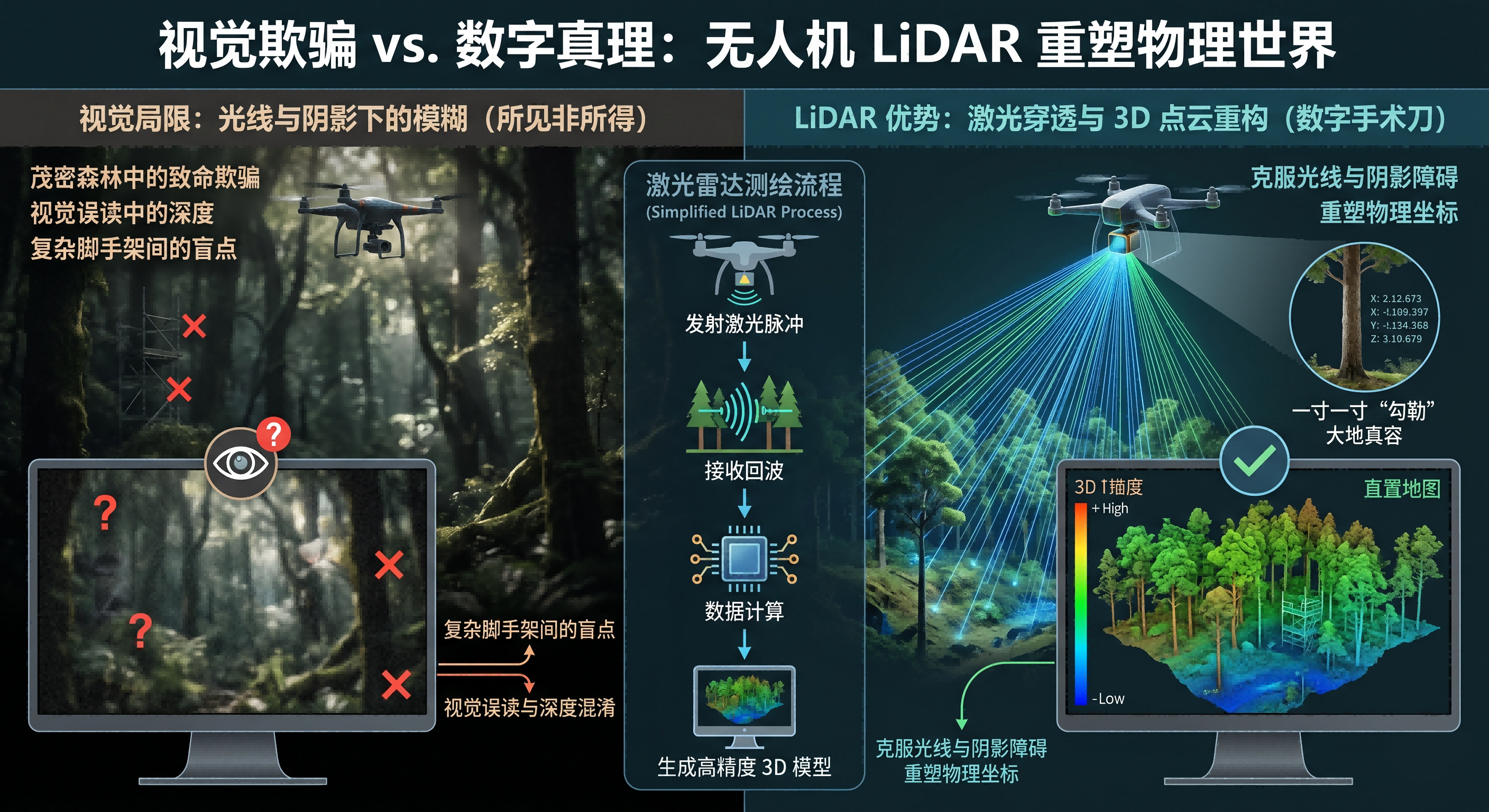
In traditional surveying and inspection, human understanding of space often relies on vision—"what you see is what you get." However, when a drone flies over dense virgin forests or weaves through complex industrial scaffolding, light and shadows often create fatal visual deceptions. To break through these limitations, engineers have equipped drones with "digital scalpels" known as LiDAR (Light Detection and Ranging). This is not just a measuring tool, but a technological revolution that reshapes the coordinates of the physical world. By emitting hundreds of thousands of laser pulses per second and receiving their echoes, it "sketches" the true contours of the earth inch by inch in dimensions inaccessible to the naked eye.
The most astonishing capability of LiDAR lies in its "penetration." This penetration is not a physical piercing, but a probabilistic coincidence. In a forest-covered area, visible light is completely blocked by lush foliage, resulting in traditional cameras only capturing the green canopy. Laser pulses, however, are different; among tens of thousands of pulses, some light spots will inevitably pass through the gaps between leaves, hit the ground, and return. Through this technology known as "multi-echo," a drone can simultaneously obtain the height of treetops and the true digital elevation model (DEM) hidden beneath the shade during flight. It is like an experienced sculptor who not only records the appearance of a work but also reconstructs its skeleton through perspective. This ability is of irreplaceable value for forest fire prevention, geological disaster assessment, and ancient building preservation, making secrets originally obscured by vegetation nowhere to hide.
Beyond large-scale topographic mapping, LiDAR also demonstrates astonishing "pixel-level" ambition in industrial-grade micro-measurement. In traditional power grid inspections, determining whether a tree is too close to a high-voltage line (the "tree-line conflict") requires personnel to carry professional equipment for close-range observation, which is extremely risky. Drones equipped with high-performance laser payloads, however, can rapidly scan entire power corridors from a height of a hundred meters. What they generate is no longer a flat photo, but a "point cloud" consisting of tens of millions of points with precise geographic coordinates (XYZ). On a computer screen, these point clouds converge like stars into a full-scale digital substation. Engineers can zoom, rotate, and measure the distance between any two points at will, with precision reaching the centimeter level. This transition from "interpreting pictures" to "data governance" marks the formal entry of the low-altitude economy into an era of quantitative analysis.
However, supporting such extreme precision requires the coordination of complex Inertial Navigation Systems (IMU) and RTK positioning technology. LiDAR itself only knows how far a target is from it; it must know its exact orientation at the moment of emission—even a 0.1-degree tilt of the fuselage in the wind would cause significant deviations on the ground. Therefore, every high-performance inspection drone is essentially a highly integrated physics laboratory. It needs to compensate for vibrations caused by airflow and correct delays in signal transmission. With the maturation of solid-state LiDAR technology, the volume of payloads is shrinking rapidly, and prices are becoming more accessible. This trend foreshadows a future where LiDAR will become a standard feature of drones, whether in constructing autonomous driving maps for smart cities or analyzing precise slopes for agricultural irrigation, serving as the "precision tentacles" for our digital civilization to understand the physical world.