The Lifeline of Low-Altitude Economy: Trajectory Planning and Link Safety Logic in Urban Canyons
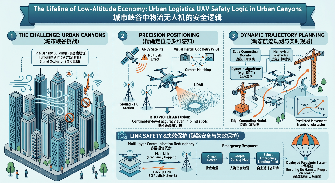
urban logistics UAVs are entering the "urban canyons" of core business districts. This high-density building environment features turbulent airflow and pervasive signal obstruction. In such settings, ensuring absolute safety is the technical baseline. Logistics UAVs must possess a "survival instinct" to independently handle emergencies, centered around multi-dimensional redundant sensing systems, dynamic path planning, and fail-safe mechanisms.
Regarding positioning, traditional GNSS faces severe "multipath effects" in city centers, leading to ballooning errors. To achieve centimeter-level positioning, modern logistics UAVs utilize a fusion architecture: combining base-station-assisted RTK with Visual Inertial Odometry (VIO). When flying into satellite blind spots, bottom-facing cameras calculate relative displacement via feature point matching, while LiDAR calibrates absolute position through point cloud matching, ensuring the aircraft does not deviate even in areas with poor signal.
In terms of trajectory planning, urban low-altitude environments are far more complex than plains. Tower cranes, buildings, and other UAVs pose real-time threats. Logistics UAVs are equipped with edge computing modules; rather than rigidly following a preset route, they use dynamic algorithms like RRT* to recalculate paths within milliseconds. This planning logic requires the system not only to "see" obstacles but also to "predict" their movement trends, enabling smooth, preemptive evasive maneuvers.
The most critical link is communication safety and fail-safe protection. In complex electromagnetic environments, UAVs establish multi-layer communication redundancy, with primary links using frequency-hopping technology and backup links relying on public 5G networks. Upon detecting a total link loss, the UAV will not land blindly; instead, it immediately triggers disaster recovery mechanisms: autonomously selecting the best emergency landing spot based on remaining battery and population density maps. Should a power failure occur, the onboard parachute system deploys instantly, ensuring no harm to people on the ground, forming the technical foundation for urban operations.